 Bedford
North Bend
Woburn
Dedham
Laconia
Merrimac
Syracuse
Addison
Norwell
Cape May
Edison
Los Angeles
New Brunswick
Amesbury
Boca Raton
Dallas
Williston
Huntley
Silver Spring
Bedford
North Bend
Woburn
Dedham
Laconia
Merrimac
Syracuse
Addison
Norwell
Cape May
Edison
Los Angeles
New Brunswick
Amesbury
Boca Raton
Dallas
Williston
Huntley
Silver Spring
King of Prussia on the map, United States
Where is located King of Prussia
Exact location — King of Prussia, Montgomery County, Pennsylvania, United States, marked on the map with a red marker.
Coordinates
King of Prussia, United States coordinates in decimal format: latitude — 40.1012856, longitude — -75.3835525. When converted to degrees, minutes, seconds King of Prussia has the following coordinates: 40°6′4.63 north latitude and -75°23′0.79 east longitude.
Population
King of Prussia, Montgomery County, Pennsylvania, United States, according to our data the population is — 18,489 residents, which is about 0% of the total population of the country (United States).
Comparison of the population on the graph:
Exact time
Time zone for this location King of Prussia — UTC -4 America/New_York. Exact time — friday, 4 april 2024 year, 19 h. 54 minutes.
Sunrise and sunset
King of Prussia, sunrise and sunset data for a date — friday 26.04.2024.
| Sunrise | Sunset | Day (duration) |
|---|---|---|
| 06:09 -2 minutes | 19:48 +1 minute | 13 h. 42 minutes. +3 minutes |
You can control the scale of the map using the auxiliary tools to find out exactly where it is located King of Prussia. When you change the scale of the map, the width of the ruler also changes (in kilometers and miles).
Nearby cities
The largest cities that are located nearby:
- Philadelphia — 25 km
- Allentown — 57 km
- Edison — 94 km
- Toms River — 102 km
- Elizabeth — 116 km
- Newark — 123 km
- Brooklyn — 134 km
- New York — 134 km
- Paterson — 136 km
- Baltimore — 138 km
- Yonkers — 154 km
- Stamford — 186 km
- Alexandria — 203 km
- Bridgeport — 218 km
- New Haven — 244 km
- Waterbury — 251 km
- Hartford — 289 km
- Springfield — 318 km
- Syracuse — 332 km
Distance to neighboring capitals:
- Ottawa
 (Canada) — 592 km
 - Belmopan
 (Belize) — 2850 km
 - Nuuk
 (Greenland) — 3086 km
 - Guatemala City
 (Guatemala) — 3195 km
 - Mexico City
 (Mexico) — 3226 km
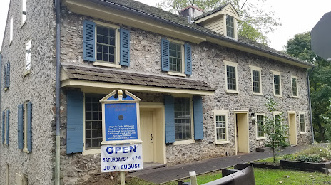
Attractions


Distance to the capital
Distance to the capital (Washington) is about — 194 km.