 Lake Zurich
Cedar Creek
Penn Yan
Wood Dale
Glendale Heights
Wyoming
Hattiesburg
Farmington
Anoka
Plaquemine
Sinton
Wilder Landing Strip
Hoboken
Rahway
Camden
Short Hills
Jesup
West Orange
Cranford
Lake Zurich
Cedar Creek
Penn Yan
Wood Dale
Glendale Heights
Wyoming
Hattiesburg
Farmington
Anoka
Plaquemine
Sinton
Wilder Landing Strip
Hoboken
Rahway
Camden
Short Hills
Jesup
West Orange
Cranford
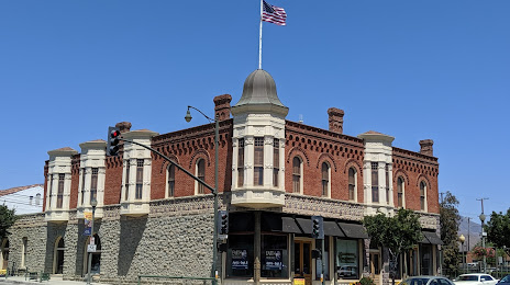
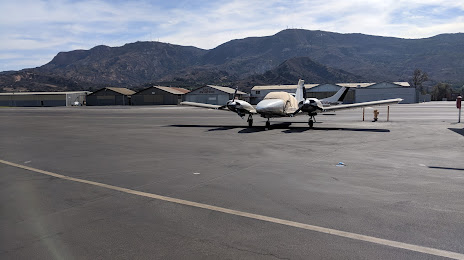
Santa Paula on the map, United States
Where is located Santa Paula
Exact location — Santa Paula, Ventura County, California, United States, marked on the map with a red marker.
Coordinates
Santa Paula, United States coordinates in decimal format: latitude — 34.3541659, longitude — -119.0592705. When converted to degrees, minutes, seconds Santa Paula has the following coordinates: 34°21′15 north latitude and -119°3′33.37 east longitude.
Population
Santa Paula, Ventura County, California, United States, according to our data the population is — 29,015 residents, which is about 0% of the total population of the country (United States).
Comparison of the population on the graph:
Exact time
Time zone for this location Santa Paula — UTC -7 America/Los_Angeles. Exact time — thursday, 4 april 2024 year, 21 h. 16 minutes.
Sunrise and sunset
Santa Paula, sunrise and sunset data for a date — thursday 25.04.2024.
| Sunrise | Sunset | Day (duration) |
|---|---|---|
| 06:14 -1 minute | 19:33 +1 minute | 13 h. 18 minutes. +2 minutes |
You can control the scale of the map using the auxiliary tools to find out exactly where it is located Santa Paula. When you change the scale of the map, the width of the ruler also changes (in kilometers and miles).
Nearby cities
The largest cities that are located nearby:
- Oxnard — 20 km
- Simi Valley — 27 km
- Thousand Oaks — 29 km
- Santa Clarita — 44 km
- Santa Clarita — 47 km
- Universal City — 69 km
- Burbank — 71 km
- Glendale — 77 km
- Inglewood — 78 km
- Los Angeles — 82 km
- Pasadena — 87 km
- Torrance — 87 km
- Palmdale — 89 km
- East Los Angeles — 90 km
- Lancaster — 90 km
- Downey — 96 km
- El Monte — 100 km
- Long Beach — 102 km
- Norwalk — 103 km
Distance to neighboring capitals:
- Mexico City
 (Mexico) — 2572 km
 - Belmopan
 (Belize) — 3558 km
 - Guatemala City
 (Guatemala) — 3605 km
 - Ottawa
 (Canada) — 3847 km
 - Nuuk
 (Greenland) — 5529 km
Attractions


Distance to the capital
Distance to the capital (Washington) is about — 3752 km.