
 Janikowo
Chrzanow
Slubice
Nowy Dwór Mazowiecki
Brodnica
Minsk Mazowiecki
Garwolin
Wegrow
Nowa Dęba
Połaniec
Starachowice
Oława
Pyskowice
Górno
Wolow
Sandomierz
Skierniewice
Brok
Gizycko
Janikowo
Chrzanow
Slubice
Nowy Dwór Mazowiecki
Brodnica
Minsk Mazowiecki
Garwolin
Wegrow
Nowa Dęba
Połaniec
Starachowice
Oława
Pyskowice
Górno
Wolow
Sandomierz
Skierniewice
Brok
Gizycko
Lubartow on the map, Poland
Where is located Lubartow
Exact location — Lubartow, Lubartów County, Lublin Voivodeship, Poland, marked on the map with a red marker.
Coordinates
Lubartow, Poland coordinates in decimal format: latitude — 51.4598694, longitude — 22.6094606. When converted to degrees, minutes, seconds Lubartow has the following coordinates: 51°27′35.53 north latitude and 22°36′34.06 east longitude.
Population
Lubartow, Lubartów County, Lublin Voivodeship, Poland, according to our data the population is — 22,839 residents, which is about 0.1% of the total population of the country (Poland).
Comparison of the population on the graph:
Exact time
Time zone for this location Lubartow — UTC +2 Europe/Warsaw. Exact time — monday, 4 april 2024 year, 16 h. 39 minutes.
Sunrise and sunset
Lubartow, sunrise and sunset data for a date — monday 29.04.2024.
| Sunrise | Sunset | Day (duration) |
|---|---|---|
| 05:08 -2 minutes | 19:45 +2 minutes | 14 h. 36 minutes. +4 minutes |
You can control the scale of the map using the auxiliary tools to find out exactly where it is located Lubartow. When you change the scale of the map, the width of the ruler also changes (in kilometers and miles).
Nearby cities
The largest cities that are located nearby:
- Lublin — 24 km
- Radom — 101 km
- Brest
 (Belarus) — 104 km
 - Kielce — 153 km
- Rzeszow — 163 km
- Bialystok — 189 km
- Tarnow — 197 km
- Łódź — 218 km
- Plock — 229 km
- Kraków — 244 km
- Pinsk (Belarus) — 247 km
- Częstochowa — 254 km
- Wloclawek — 272 km
- Rivne
 (Ukraine) — 272 km
 - Dabrowa Gornicza — 272 km
- Sosnowiec — 280 km
- Katowice — 286 km
- Bytom — 288 km
- Chorzow — 288 km
Distance to neighboring capitals:
- Vilnius
 (Lithuania) — 401 km
 - Minsk (Belarus) — 430 km
- Budapest
 (Hungary) — 510 km
 - Bratislava
 (Slovakia) — 540 km
 - Kyiv (Ukraine) — 565 km
- Vienna
 (Austria) — 575 km
 - Prague
 (Czech Republic) — 595 km
 - Rīga
 (Latvia) — 618 km
 - Berlin
 (Germany) — 641 km
 - Belgrade
 (Serbia) — 759 km
 - Copenhagen
 (Denmark) — 811 km
 - Bucharest
 (Romania) — 824 km
 - Helsinki
 (Finland) — 980 km
 - Moscow
 (Russia) — 1097 km
 - Bern
 (Switzerland) — 1208 km
 - Amsterdam
 (Netherlands) — 1216 km
 - Paris
 (France) — 1467 km
 - Tbilisi
 (Georgia) — 2000 km
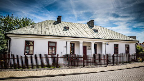
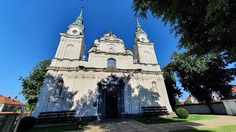
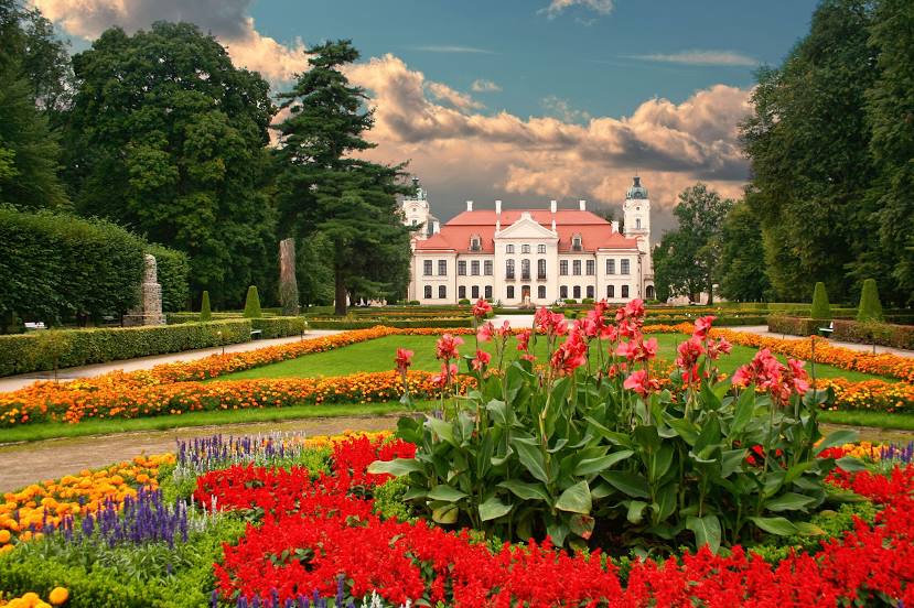
Attractions


Distance to the capital
Distance to the capital (Warsaw) is about — 139 km.