Sulphur Springs — Rochester
Sulphur Springs — El Mirage
Sulphur Springs — Sapa
Sulphur Springs — Shiloh
Sulphur Springs — Alba
Sulphur Springs — Wallaceton
Sulphur Springs — Perrysburg
Sulphur Springs — Hannibal
Sulphur Springs — Kit Carson
Sulphur Springs — Keswick
Sulphur Springs — Moore County
Sulphur Springs — Torrey
Sulphur Springs — Thornhill
Sulphur Springs — Nice
Sulphur Springs — Wessington Springs
Sulphur Springs — Cloverdale
Sulphur Springs — Isabella
Sulphur Springs — Rathdrum
Sulphur Springs — Ludlow
Cumby
Hunt County
Farmersville
Collin County
McKinney
Frisco
Little Elm
Denton
Krum
Wise County
Alvord
Wichita Falls
Iowa Park
Electra
Chillicothe
Quanah
Childress
Hedley
Claude
Rick Husband Amarillo International Airport
Amarillo
Channing
Dalhart
Perico
Texline
Des Moines
Capulin
Raton
Trinidad
Ludlow
Aguilar
Walsenburg
Pueblo
Fountain
Colorado Springs
Sulphur Springs — Rochester
Sulphur Springs — El Mirage
Sulphur Springs — Sapa
Sulphur Springs — Shiloh
Sulphur Springs — Alba
Sulphur Springs — Wallaceton
Sulphur Springs — Perrysburg
Sulphur Springs — Hannibal
Sulphur Springs — Kit Carson
Sulphur Springs — Keswick
Sulphur Springs — Moore County
Sulphur Springs — Torrey
Sulphur Springs — Thornhill
Sulphur Springs — Nice
Sulphur Springs — Wessington Springs
Sulphur Springs — Cloverdale
Sulphur Springs — Isabella
Sulphur Springs — Rathdrum
Sulphur Springs — Ludlow
Cumby
Hunt County
Farmersville
Collin County
McKinney
Frisco
Little Elm
Denton
Krum
Wise County
Alvord
Wichita Falls
Iowa Park
Electra
Chillicothe
Quanah
Childress
Hedley
Claude
Rick Husband Amarillo International Airport
Amarillo
Channing
Dalhart
Perico
Texline
Des Moines
Capulin
Raton
Trinidad
Ludlow
Aguilar
Walsenburg
Pueblo
Fountain
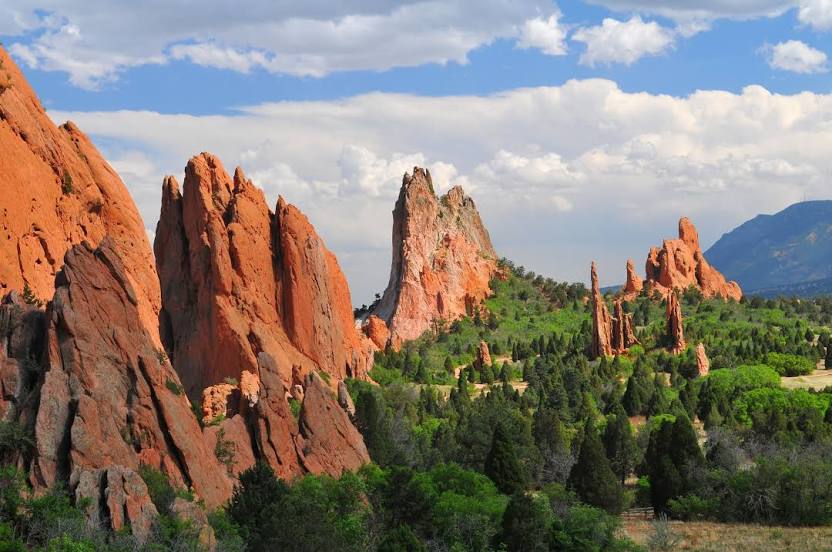
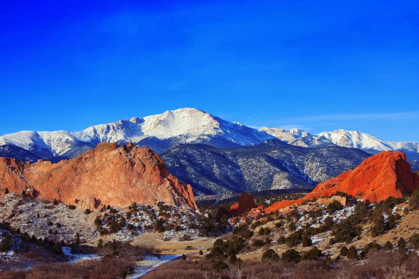
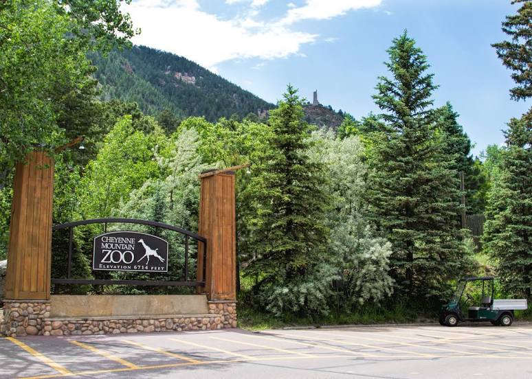
Colorado Springs
Sulphur Springs — Colorado Springs distance, route on the map
Distance by car
Distance between Sulphur Springs, Texas, United States and Colorado Springs, Colorado, United States by car is — km, or miles. To travel this distance by car, you need minute, or h.
Route on the map, driving directions
Car route Sulphur Springs — Colorado Springs was created automatically. The road on the map is shown as a blue line. By moving the markers, you can create a new route through the points you need.
Passing cities through which the car route passes: Brashear, Cumby, Hunt County, Farmersville, Collin County, McKinney, Frisco, Little Elm, Denton, Krum, Wise County, Alvord, Wichita Falls, Iowa Park, Electra, Chillicothe, Quanah, Childress, Hedley, Claude, Rick Husband Amarillo International Airport, Amarillo, Channing, Dalhart, Perico, Texline, Des Moines, Capulin, Raton, Trinidad, Ludlow, Aguilar, Walsenburg, Pueblo, Fountain, Colorado Springs.
Distance by plane
If you decide to take a trip Sulphur Springs Colorado Springs by plane, then you have to fly the distance — 1043 km or 647 miles. It is marked on the map with a gray line (between two points in a straight line).
Flight time
Estimated flight time Sulphur Springs Colorado Springs by plane at cruising speed 750 km / h will be — 1 h. and 23 min.
Direction of movement
United States, Sulphur Springs — right-hand traffic. United States, Colorado Springs — right-hand traffic.
Difference in time
Sulphur Springs and Colorado Springs are in different time zones. The time difference is 1 hour (UTC -5 America/Chicago, UTC -6 America/Denver).
Interesting Facts
Information on alternative ways to get to your destination.
The length of this distance is about 2.6% of the total length of the equator.
The percentage of the population is clearly shown in the graph:
Sulphur Springs — 15,029 (less by 358,043), Colorado Springs — 373,072 residents.
The cost of travel
Calculate the cost of the trip yourself using the fuel consumption calculator, changing the data in the table.