
 Kluczbork
Płośnica
Rybno
Załuski
Szreńsk
Grudusk
Czernice Borowe
Lipiany
Nowa Sarzyna
Łask
Zdunska Wola
Glogow
Grunwald
Łambinowice
Nowa Dęba
Wegrow
Garwolin
Minsk Mazowiecki
Brodnica
Kluczbork
Płośnica
Rybno
Załuski
Szreńsk
Grudusk
Czernice Borowe
Lipiany
Nowa Sarzyna
Łask
Zdunska Wola
Glogow
Grunwald
Łambinowice
Nowa Dęba
Wegrow
Garwolin
Minsk Mazowiecki
Brodnica
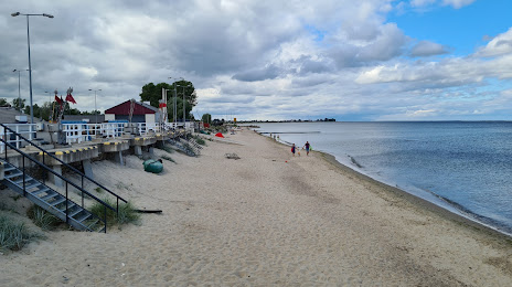
Reda on the map, Poland
Where is located Reda
Exact location — Reda, Wejherowo County, Pomeranian Voivodeship, Poland, marked on the map with a red marker.
Coordinates
Reda, Poland coordinates in decimal format: latitude — 54.6053867, longitude — 18.3471836. When converted to degrees, minutes, seconds Reda has the following coordinates: 54°36′19.39 north latitude and 18°20′49.86 east longitude.
Population
Reda, Wejherowo County, Pomeranian Voivodeship, Poland, according to our data the population is — 18,116 residents, which is about 0% of the total population of the country (Poland).
Comparison of the population on the graph:
Exact time
Time zone for this location Reda — UTC +2 Europe/Warsaw. Exact time — sunday, 5 may 2024 year, 12 h. 02 minutes.
Sunrise and sunset
Reda, sunrise and sunset data for a date — sunday 12.05.2024.
| Sunrise | Sunset | Day (duration) |
|---|---|---|
| 04:49 -2 minutes | 20:36 +2 minutes | 15 h. 48 minutes. +4 minutes |
You can control the scale of the map using the auxiliary tools to find out exactly where it is located Reda. When you change the scale of the map, the width of the ruler also changes (in kilometers and miles).
Nearby cities
The largest cities that are located nearby:
- Gdynia — 15 km
- Gdańsk — 34 km
- Elblag — 85 km
- Kaliningrad
 (Russia) — 139 km
 - Koszalin — 148 km
- Bydgoszcz — 165 km
- Olsztyn — 167 km
- Torun — 177 km
- Klaipėda
 (Lithuania) — 212 km
 - Wloclawek — 222 km
- Plock — 245 km
- Poznań — 261 km
- Szczecin — 282 km
- Gorzów Wielkopolski — 294 km
- Kalisz — 314 km
- Łódź — 324 km
- Šiauliai (Lithuania) — 341 km
- Malmö
 (Sweden) — 352 km
 - Zielona Gora — 353 km
Distance to neighboring capitals:
- Copenhagen
 (Denmark) — 386 km
 - Berlin
 (Germany) — 400 km
 - Rīga
 (Latvia) — 444 km
 - Vilnius (Lithuania) — 446 km
- Prague
 (Czech Republic) — 569 km
 - Minsk
 (Belarus) — 603 km
 - Bratislava
 (Slovakia) — 724 km
 - Vienna
 (Austria) — 725 km
 - Helsinki
 (Finland) — 734 km
 - Budapest
 (Hungary) — 792 km
 - Amsterdam
 (Netherlands) — 923 km
 - Kyiv
 (Ukraine) — 943 km
 - Belgrade
 (Serbia) — 1102 km
 - Bern
 (Switzerland) — 1143 km
 - Moscow (Russia) — 1226 km
- Bucharest
 (Romania) — 1261 km
 - Paris
 (France) — 1270 km
 - Tbilisi
 (Georgia) — 2406 km
Attractions


Distance to the capital
Distance to the capital (Warsaw) is about — 318 km.