Beaver Crossing — Fairfax
Beaver Crossing — Umber View Heights
Beaver Crossing — Woodson
Beaver Crossing — Weaubleau
Beaver Crossing — Goodwin
Beaver Crossing — St. Francis County
Beaver Crossing — Vulcan
Beaver Crossing — Ely
Beaver Crossing — Looneyville
Beaver Crossing — Iowa Falls
Beaver Crossing — Landisville
Beaver Crossing — Berryton
Beaver Crossing — Sperry
Beaver Crossing — Trego
Beaver Crossing — High Point
Beaver Crossing — Portland
Beaver Crossing — Amana
Beaver Crossing — Land O' Lakes
Beaver Crossing — Petrolia
Aurora
Giltner
Alda
Gibbon
Kearney
Lexington
Cozad
Gothenburg
North Platte
Hershey
Ogallala
Julesburg
Chappell
Lodgepole
Kimball
Cheyenne
Laramie
Elk Mountain
Sinclair
Rawlins
Rock Springs
Lyman
Fort Bridger
Coalville
Park City
Holladay
Salt Lake City
Midvale
South Jordan
Draper
Bluffdale
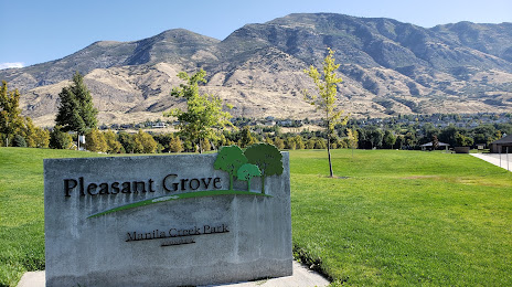
Lehi
Lehi
Beaver Crossing — Fairfax
Beaver Crossing — Umber View Heights
Beaver Crossing — Woodson
Beaver Crossing — Weaubleau
Beaver Crossing — Goodwin
Beaver Crossing — St. Francis County
Beaver Crossing — Vulcan
Beaver Crossing — Ely
Beaver Crossing — Looneyville
Beaver Crossing — Iowa Falls
Beaver Crossing — Landisville
Beaver Crossing — Berryton
Beaver Crossing — Sperry
Beaver Crossing — Trego
Beaver Crossing — High Point
Beaver Crossing — Portland
Beaver Crossing — Amana
Beaver Crossing — Land O' Lakes
Beaver Crossing — Petrolia
Aurora
Giltner
Alda
Gibbon
Kearney
Lexington
Cozad
Gothenburg
North Platte
Hershey
Ogallala
Julesburg
Chappell
Lodgepole
Kimball
Cheyenne
Laramie
Elk Mountain
Sinclair
Rawlins
Rock Springs
Lyman
Fort Bridger
Coalville
Park City
Holladay
Salt Lake City
Midvale
South Jordan
Draper
Bluffdale
Lehi
Lehi
Beaver Crossing — American Fork distance, route on the map
Distance by car
Distance between Beaver Crossing, Nebraska, United States and American Fork, Utah, United States by car is — km, or miles. To travel this distance by car, you need minute, or h.
Route on the map, driving directions
Car route Beaver Crossing — American Fork was created automatically. The road on the map is shown as a blue line. By moving the markers, you can create a new route through the points you need.
Passing cities through which the car route passes: York, Aurora, Giltner, Alda, Gibbon, Kearney, Lexington, Cozad, Gothenburg, North Platte, Hershey, Ogallala, Julesburg, Chappell, Lodgepole, Kimball, Cheyenne, Laramie, Elk Mountain, Sinclair, Rawlins, Rock Springs, Lyman, Fort Bridger, Coalville, Park City, Holladay, Salt Lake City, Midvale, South Jordan, Draper, Bluffdale, Lehi, Lehi.
Distance by plane
If you decide to take a trip Beaver Crossing American Fork by plane, then you have to fly the distance — 1226 km or 760 miles. It is marked on the map with a gray line (between two points in a straight line).
Flight time
Estimated flight time Beaver Crossing American Fork by plane at cruising speed 750 km / h will be — 1 h. and 38 min.
Direction of movement
United States, Beaver Crossing — right-hand traffic. United States, American Fork — right-hand traffic.
Difference in time
Beaver Crossing and American Fork are in different time zones. The time difference is 1 hour (UTC -5 America/Chicago, UTC -6 America/Denver).
Interesting Facts
Information on alternative ways to get to your destination.
The length of this distance is about 3.1% of the total length of the equator.
The percentage of the population is clearly shown in the graph:
Beaver Crossing — 430 (less by 23,152), American Fork — 23,582 residents.
The cost of travel
Calculate the cost of the trip yourself using the fuel consumption calculator, changing the data in the table.