Amapá — Itacurubi
Amapá — Cacoal
Amapá — Itajobi
Amapá — Varginha
Amapá — Itapipoca
Amapá — Toropi
Amapá — Tubarão
Amapá — Mato Verde
Amapá — Mangaratiba
Amapá — Tiradentes
Amapá — São Bento do Una
Amapá — Km 12
Amapá — Km 40
Amapá — Chaves
Amapá — Nazaré Paulista
Amapá — Petrolina
Amapá — Quixadá
Amapá — Flores
Amapá — Joaquim Távora
Macapá
Breves
Bagre
Belém
Val de Cans International Airport
Ananindeua
Acará
Imperatriz
Porto Franco
Araguaína
Nova Olinda
Colinas do Tocantins
Miranorte
Paraíso do Tocantins
Gurupi
Cariri do Tocantins
Porangatu
Uruaçu
Rialma
Nerópolis
Goiânia Airport
Goiânia
Hidrolândia
Morrinhos
Itumbiara
Araporã
Centralina
Monte Alegre de Minas
Uberlândia
Uru
Uberaba
Igarapava
Aramina
Ituverava
Guará
São Joaquim da Barra
São Joaquim da Barra
Orlândia
Sales Oliveira
Jardinópolis
Ribeirão Preto
Ribeirão Preto
Cravinhos
Luís Antônio
Porto Ferreira
Pirassununga
Santa Cruz da Conceição
Leme
Araras
Cordeirópolis
Limeira
Americana
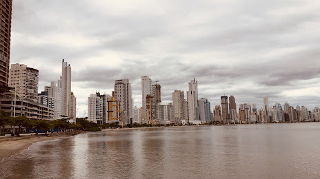
Amapá — Barra Velha distance, route on the map
Distance by car
Distance between Amapá, Amapá, Brazil and Barra Velha, Santa Catarina, Brazil by car is — km, or miles. To travel this distance by car, you need minute, or h.
Route on the map, driving directions
Car route Amapá — Barra Velha was created automatically. The road on the map is shown as a blue line. By moving the markers, you can create a new route through the points you need.
Passing cities through which the car route passes: Porto Grande, Macapá, Breves, Bagre, Belém, Val de Cans International Airport, Ananindeua, Acará, Imperatriz, Porto Franco, Araguaína, Nova Olinda, Colinas do Tocantins, Miranorte, Paraíso do Tocantins, Gurupi, Cariri do Tocantins, Porangatu, Uruaçu, Rialma, Nerópolis, Goiânia Airport, Goiânia, Hidrolândia, Morrinhos, Itumbiara, Araporã, Centralina, Monte Alegre de Minas, Uberlândia, Uru, Uberaba, Igarapava, Aramina, Ituverava, Guará, São Joaquim da Barra, São Joaquim da Barra, Orlândia, Sales Oliveira, Jardinópolis, Ribeirão Preto, Ribeirão Preto, Cravinhos, Luís Antônio, Porto Ferreira, Pirassununga, Santa Cruz da Conceição, Leme, Araras, Cordeirópolis, Limeira, Americana.
Distance by plane
If you decide to take a trip Amapá Barra Velha by plane, then you have to fly the distance — 3198 km or 1983 miles. It is marked on the map with a gray line (between two points in a straight line).
Flight time
Estimated flight time Amapá Barra Velha by plane at cruising speed 750 km / h will be — 4 h. and 15 min.
Direction of movement
Brazil, Amapá — right-hand traffic. Brazil, Barra Velha — right-hand traffic.
Difference in time
Amapá and Barra Velha are in the same time zone. Between them there is no time difference (UTC -3 America/Fortaleza).
Interesting Facts
Information on alternative ways to get to your destination.
The length of this distance is about 8.0% of the total length of the equator.
The cost of travel
Calculate the cost of the trip yourself using the fuel consumption calculator, changing the data in the table.