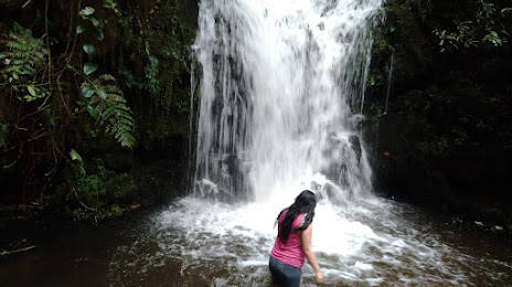
El Carmelo — El Viajano
El Carmelo — Gachantivá
El Carmelo — San Angel
El Carmelo — The Morea
El Carmelo — Gualmatán
El Carmelo — Aguazul
El Carmelo — La Loma
El Carmelo — Viracachá
El Carmelo — Guayatá
El Carmelo — Uribia
El Carmelo — La Vega
El Carmelo — Quimbaya
El Carmelo — San Martin
El Carmelo — Filadelfia
El Carmelo — Medellin
El Carmelo — Barrancabermeja
El Carmelo — El Morro
El Carmelo — Santa Marta
El Carmelo — Piendamó
 Teques
Tulcan
Tulcan
Ipiales
Ipiales
Ipiales
Potosí
Contadero
Iles
Funes
Imués
Tangua
Yacuanquer
Pasto
Santiago
Sibundoy
San Francisco
Mocoa
Villagarzón
Pitalito
Timana-Altamira
Tarqui
La Jagua
Garzon
La Vega
Gigante
Huila
Hobo
Campoalegre
Campoalegre
Escalereta
Palermo
El Juncal
Santa Barbara
Neiva
Aipe
Aipe
Natagaima
Tamarindo
Castilla
Saldana
Guamo
Espinal
Flandes
Flandes
Tolemaida
Melgar
Nilo
Fusagasugá
Fusagasugá
Fusagasuga
Santa Rita Baja
Teques
Tulcan
Tulcan
Ipiales
Ipiales
Ipiales
Potosí
Contadero
Iles
Funes
Imués
Tangua
Yacuanquer
Pasto
Santiago
Sibundoy
San Francisco
Mocoa
Villagarzón
Pitalito
Timana-Altamira
Tarqui
La Jagua
Garzon
La Vega
Gigante
Huila
Hobo
Campoalegre
Campoalegre
Escalereta
Palermo
El Juncal
Santa Barbara
Neiva
Aipe
Aipe
Natagaima
Tamarindo
Castilla
Saldana
Guamo
Espinal
Flandes
Flandes
Tolemaida
Melgar
Nilo
Fusagasugá
Fusagasugá
Fusagasuga
Santa Rita Baja
El Carmelo — Sibaté distance, route on the map
Distance by car
Distance between El Carmelo, Nariño, Colombia and Sibaté, Cundinamarca, Colombia by car is — km, or miles. To travel this distance by car, you need minute, or h.
Route on the map, driving directions
Car route El Carmelo — Sibaté was created automatically. The road on the map is shown as a blue line. By moving the markers, you can create a new route through the points you need.
Passing cities through which the car route passes: Julio Andrade (ec), Teques, Tulcan (ec), Tulcan (ec), Ipiales, Ipiales, Ipiales, Potosí, Contadero, Iles, Funes, Imués, Tangua, Yacuanquer, Pasto, Santiago, Sibundoy, San Francisco, Mocoa, Villagarzón, Pitalito, Timana-Altamira, Tarqui, La Jagua, Garzon, La Vega, Gigante, Huila, Hobo, Campoalegre, Campoalegre, Escalereta, Palermo, El Juncal, Santa Barbara, Neiva, Aipe, Aipe, Natagaima, Tamarindo, Castilla, Saldana, Guamo, Espinal, Flandes, Flandes, Tolemaida, Melgar, Nilo, Fusagasugá, Fusagasugá, Fusagasuga, Santa Rita Baja.
Distance by plane
If you decide to take a trip El Carmelo Sibaté by plane, then you have to fly the distance — 564 km or 350 miles. It is marked on the map with a gray line (between two points in a straight line).
Flight time
Estimated flight time El Carmelo Sibaté by plane at cruising speed 750 km / h will be — 45 min.
Direction of movement
Colombia, El Carmelo — right-hand traffic. Colombia, Sibaté — right-hand traffic.
Difference in time
El Carmelo and Sibaté are in the same time zone. Between them there is no time difference (UTC -5 America/Guayaquil).
Interesting Facts
Information on alternative ways to get to your destination.
The length of this distance is about 1.4% of the total length of the equator.
The cost of travel
Calculate the cost of the trip yourself using the fuel consumption calculator, changing the data in the table.