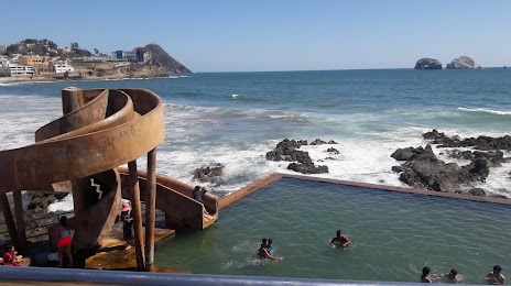
Puerto Vallarta — Villa Corona
Puerto Vallarta — Tetiz Municipality
Puerto Vallarta — Linares
Puerto Vallarta — San Juan Guichicovi
Puerto Vallarta — Santa Rosalía
Puerto Vallarta — San Felipe
Puerto Vallarta — Pajapan
Puerto Vallarta — San Jacinto
Puerto Vallarta — Playa del Carmen
Puerto Vallarta — Almoloya de Juárez
Puerto Vallarta — Ixtlán del Río
Puerto Vallarta — El Carrizal
Puerto Vallarta — Jalapa
Puerto Vallarta — Zinapecuaro de Figueroa
Puerto Vallarta — Tlaltenango de Sánchez Román
Puerto Vallarta — The meetings
Puerto Vallarta — Santiago Tangamandapio
Puerto Vallarta — San José de la Peña
Puerto Vallarta — Tapijulapa
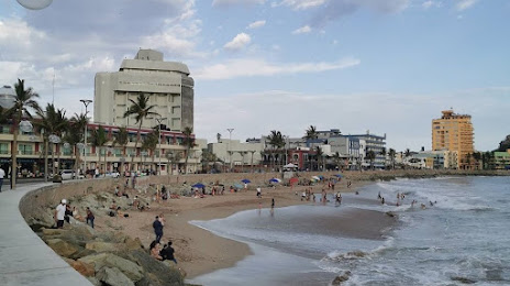
Nuevo Vallarta
San Vicente
Bucerías
Sayulita
San Francisco
Punta Raza
Rincón de Guayabitos
Rincón de Guayabitos
Chacala
Las Varas
Compostela
Xalisco
Tepic
Guayabitos
La Guinea
Yago Station
El Capomal
Ruiz
Paso Real del Bejuco
Rosamorada
Tecuala
La Concha
Reform
El Rosario
El Huajote
Villa Unión
Mazatlán International Airport
Puerto Vallarta — Villa Corona
Puerto Vallarta — Tetiz Municipality
Puerto Vallarta — Linares
Puerto Vallarta — San Juan Guichicovi
Puerto Vallarta — Santa Rosalía
Puerto Vallarta — San Felipe
Puerto Vallarta — Pajapan
Puerto Vallarta — San Jacinto
Puerto Vallarta — Playa del Carmen
Puerto Vallarta — Almoloya de Juárez
Puerto Vallarta — Ixtlán del Río
Puerto Vallarta — El Carrizal
Puerto Vallarta — Jalapa
Puerto Vallarta — Zinapecuaro de Figueroa
Puerto Vallarta — Tlaltenango de Sánchez Román
Puerto Vallarta — The meetings
Puerto Vallarta — Santiago Tangamandapio
Puerto Vallarta — San José de la Peña
Puerto Vallarta — Tapijulapa
Nuevo Vallarta
San Vicente
Bucerías
Sayulita
San Francisco
Punta Raza
Rincón de Guayabitos
Rincón de Guayabitos
Chacala
Las Varas
Compostela
Xalisco
Tepic
Guayabitos
La Guinea
Yago Station
El Capomal
Ruiz
Paso Real del Bejuco
Rosamorada
Tecuala
La Concha
Reform
El Rosario
El Huajote
Villa Unión
Mazatlán International Airport
Puerto Vallarta — Mazatlán distance, route on the map
Distance by car
Distance between Puerto Vallarta, Jalisco, Mexico and Mazatlán, Sinaloa, Mexico by car is — km, or miles. To travel this distance by car, you need minute, or h.
Route on the map, driving directions
Car route Puerto Vallarta — Mazatlán was created automatically. The road on the map is shown as a blue line. By moving the markers, you can create a new route through the points you need.
Passing cities through which the car route passes: The meetings, Nuevo Vallarta, San Vicente, Bucerías, Sayulita, San Francisco, Punta Raza, Rincón de Guayabitos, Rincón de Guayabitos, Chacala, Las Varas, Compostela, Xalisco, Tepic, Guayabitos, La Guinea, Yago Station, El Capomal, Ruiz, Paso Real del Bejuco, Rosamorada, Tecuala, La Concha, Reform, El Rosario, El Huajote, Villa Unión, Mazatlán International Airport.
Distance by plane
If you decide to take a trip Puerto Vallarta Mazatlán by plane, then you have to fly the distance — 314 km or 195 miles. It is marked on the map with a gray line (between two points in a straight line).
Flight time
Estimated flight time Puerto Vallarta Mazatlán by plane at cruising speed 750 km / h will be — 25 min.
Direction of movement
Mexico, Puerto Vallarta — right-hand traffic. Mexico, Mazatlán — right-hand traffic.
Difference in time
Puerto Vallarta and Mazatlán are in different time zones. The time difference is 1 hour (UTC -6 America/Mexico_City, UTC -7 America/Mazatlan).
Interesting Facts
Information on alternative ways to get to your destination.
The length of this distance is about 0.8% of the total length of the equator.
The percentage of the population is clearly shown in the graph:
Puerto Vallarta — 187,143 (less by 167,587), Mazatlán — 354,730 residents.
The cost of travel
Calculate the cost of the trip yourself using the fuel consumption calculator, changing the data in the table.