
 Virtus
Ayesa
Mairena del Alcor
Aras de los Olmos
El Viso del Alcor
Valdeprado del Río
Solares
Lloseta
Riego
Llano de Olmedo
Lloret de Mar
Herreros de Suso
Montmeló
Polinyà
Alhama de Aragón
Sotelo
Totana
Torremolinos
Bullas
Virtus
Ayesa
Mairena del Alcor
Aras de los Olmos
El Viso del Alcor
Valdeprado del Río
Solares
Lloseta
Riego
Llano de Olmedo
Lloret de Mar
Herreros de Suso
Montmeló
Polinyà
Alhama de Aragón
Sotelo
Totana
Torremolinos
Bullas
Daimiel on the map, Spain
Where is located Daimiel
Exact location — Daimiel, Ciudad Real, Castilla-La Mancha, Spain, marked on the map with a red marker.
Coordinates
Daimiel, Spain coordinates in decimal format: latitude — 39.0699215, longitude — -3.6141819. When converted to degrees, minutes, seconds Daimiel has the following coordinates: 39°4′11.72 north latitude and -3°36′51.05 east longitude.
Population
Daimiel, Ciudad Real, Castilla-La Mancha, Spain, according to our data the population is — 17,466 residents, which is about 0% of the total population of the country (Spain).
Comparison of the population on the graph:
Exact time
Time zone for this location Daimiel — UTC +2 Europe/Madrid. Exact time — tuesday, 5 may 2024 year, 23 h. 07 minutes.
Sunrise and sunset
Daimiel, sunrise and sunset data for a date — tuesday 14.05.2024.
| Sunrise | Sunset | Day (duration) |
|---|---|---|
| 07:05 -0 minutes | 21:16 +1 minute | 14 h. 12 minutes. +1 minute |
You can control the scale of the map using the auxiliary tools to find out exactly where it is located Daimiel. When you change the scale of the map, the width of the ruler also changes (in kilometers and miles).
Nearby cities
The largest cities that are located nearby:
- Fuenlabrada — 136 km
- Getafe — 137 km
- Leganés — 140 km
- Móstoles — 140 km
- Alcorcón — 142 km
- Jaén — 143 km
- Albacete — 151 km
- Torrejón de Ardoz — 154 km
- Alcala de Henares — 158 km
- Alcobendas — 162 km
- Córdoba — 166 km
- Granada — 209 km
- Murcia — 247 km
- Almería — 267 km
- Málaga — 269 km
- Salamanca — 271 km
- Cartagena — 279 km
- Valencia — 280 km
- Dos Hermanas — 283 km
Distance to neighboring capitals:
- Lisbon
 (Portugal) — 480 km
 - Andorra la Vella
 (Andorra) — 577 km
 - Rabat
 (Morocco) — 636 km
 - Paris
 (France) — 1188 km
 - Paris (France) — 1188 km
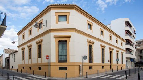
Attractions
Distance to the capital
Distance to the capital (Madrid) is about — 150 km.