Ji-Paraná — Macau
Ji-Paraná — Ibipeba
Ji-Paraná — Centro
Ji-Paraná — Guaratuba
Ji-Paraná — Viamão
Ji-Paraná — Cruzeiro do Sul
Ji-Paraná — Guaraciaba
Ji-Paraná — Bacabal
Ji-Paraná — Caracol
Ji-Paraná — Morro do Pilar
Ji-Paraná — Boa Vista do Buricá
Ji-Paraná — Atlântico
Ji-Paraná — Cachoeira do Sul
Ji-Paraná — Saudades
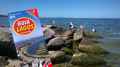
Ji-Paraná — Arraial do Cabo
Ji-Paraná — Pereiras
Ji-Paraná — Oliveira
Ji-Paraná — Rio Verde de Mato Grosso
Ji-Paraná — Água Boa
Cacoal
Pimenta Bueno
Vilhena
Zico
Comodoro
Nova Lacerda
Pontes e Lacerda
Cáceres
Cáceres
Várzea Grande
Marechal Rondon International Airport
Cuiaba
Jaciara
Rondonópolis
Alto Araguaia
Santa Rita do Araguaia
Cassilândia
Paranaíba
Santa Clara D'Oeste
Santa Fé do Sul
Urânia
Jales
Estrela D'Oeste
Valentim Gentil
Cosmorama
Tanabi
Mirassol
Sao Jose de Rio Preto
Cedral
Uchoa
Catanduva
Pindorama
Santa Adélia
Matão
Ibaté
São Carlos
Itirapina
São Paulo
Rio Claro
Santa Gertrudes
Cordeirópolis
Limeira
Americana
Jardim Thelja
Nova Odessa
Sumaré
Hortolândia
Campinas
Sousas
Itatiba
Jarinu
Atibaia
Ji-Paraná — Macau
Ji-Paraná — Ibipeba
Ji-Paraná — Centro
Ji-Paraná — Guaratuba
Ji-Paraná — Viamão
Ji-Paraná — Cruzeiro do Sul
Ji-Paraná — Guaraciaba
Ji-Paraná — Bacabal
Ji-Paraná — Caracol
Ji-Paraná — Morro do Pilar
Ji-Paraná — Boa Vista do Buricá
Ji-Paraná — Atlântico
Ji-Paraná — Cachoeira do Sul
Ji-Paraná — Saudades
Ji-Paraná — Arraial do Cabo
Ji-Paraná — Pereiras
Ji-Paraná — Oliveira
Ji-Paraná — Rio Verde de Mato Grosso
Ji-Paraná — Água Boa
Cacoal
Pimenta Bueno
Vilhena
Zico
Comodoro
Nova Lacerda
Pontes e Lacerda
Cáceres
Cáceres
Várzea Grande
Marechal Rondon International Airport
Cuiaba
Jaciara
Rondonópolis
Alto Araguaia
Santa Rita do Araguaia
Cassilândia
Paranaíba
Santa Clara D'Oeste
Santa Fé do Sul
Urânia
Jales
Estrela D'Oeste
Valentim Gentil
Cosmorama
Tanabi
Mirassol
Sao Jose de Rio Preto
Cedral
Uchoa
Catanduva
Pindorama
Santa Adélia
Matão
Ibaté
São Carlos
Itirapina
São Paulo
Rio Claro
Santa Gertrudes
Cordeirópolis
Limeira
Americana
Jardim Thelja
Nova Odessa
Sumaré
Hortolândia
Campinas
Sousas
Itatiba
Jarinu
Atibaia
Ji-Paraná — Araruama distance, route on the map
Distance by car
Distance between Ji-Paraná, Rondônia, Brazil and Araruama, Rio de Janeiro, Brazil by car is — km, or miles. To travel this distance by car, you need minute, or h.
Route on the map, driving directions
Car route Ji-Paraná — Araruama was created automatically. The road on the map is shown as a blue line. By moving the markers, you can create a new route through the points you need.
Passing cities through which the car route passes: Presidente Médici, Cacoal, Pimenta Bueno, Vilhena, Zico, Comodoro, Nova Lacerda, Pontes e Lacerda, Cáceres, Cáceres, Várzea Grande, Marechal Rondon International Airport, Cuiaba, Jaciara, Rondonópolis, Alto Araguaia, Santa Rita do Araguaia, Cassilândia, Paranaíba, Santa Clara D'Oeste, Santa Fé do Sul, Urânia, Jales, Estrela D'Oeste, Valentim Gentil, Cosmorama, Tanabi, Mirassol, Sao Jose de Rio Preto, Cedral, Uchoa, Catanduva, Pindorama, Santa Adélia, Matão, Ibaté, São Carlos, Itirapina, São Paulo, Rio Claro, Santa Gertrudes, Cordeirópolis, Limeira, Americana, Jardim Thelja, Nova Odessa, Sumaré, Hortolândia, Campinas, Sousas, Itatiba, Jarinu, Atibaia.
Distance by plane
If you decide to take a trip Ji-Paraná Araruama by plane, then you have to fly the distance — 2471 km or 1532 miles. It is marked on the map with a gray line (between two points in a straight line).
Flight time
Estimated flight time Ji-Paraná Araruama by plane at cruising speed 750 km / h will be — 3 h. and 17 min.
Direction of movement
Brazil, Ji-Paraná — right-hand traffic. Brazil, Araruama — right-hand traffic.
Difference in time
Ji-Paraná and Araruama are in different time zones. The time difference is 1 hour (UTC -4 America/Boa_Vista, UTC -3 America/Sao_Paulo).
Interesting Facts
Information on alternative ways to get to your destination.
The length of this distance is about 6.2% of the total length of the equator.
The cost of travel
Calculate the cost of the trip yourself using the fuel consumption calculator, changing the data in the table.