
 Torredonjimeno
Aceuchal
Vila-seca
Almodóvar del Pinar
Son Servera
La Vall d'Uixó
Tricio
Madremanya
Benicàssim
Oleiros
Monforte de Lemos
Sopelana
Villadecanes
Pliego
Arroyo del Ojanco
Palol de Revardit
Moncofa
Almussafes
Albal
Torredonjimeno
Aceuchal
Vila-seca
Almodóvar del Pinar
Son Servera
La Vall d'Uixó
Tricio
Madremanya
Benicàssim
Oleiros
Monforte de Lemos
Sopelana
Villadecanes
Pliego
Arroyo del Ojanco
Palol de Revardit
Moncofa
Almussafes
Albal
Bolaños de Calatrava on the map, Spain
Where is located Bolaños de Calatrava
Exact location — Bolaños de Calatrava, Ciudad Real, Castilla-La Mancha, Spain, marked on the map with a red marker.
Coordinates
Bolaños de Calatrava, Spain coordinates in decimal format: latitude — 38.9068623, longitude — -3.664859. When converted to degrees, minutes, seconds Bolaños de Calatrava has the following coordinates: 38°54′24.7 north latitude and -3°39′53.49 east longitude.
Population
Bolaños de Calatrava, Ciudad Real, Castilla-La Mancha, Spain, according to our data the population is — 11,535 residents, which is about 0% of the total population of the country (Spain).
Comparison of the population on the graph:
Exact time
Time zone for this location Bolaños de Calatrava — UTC +2 Europe/Madrid. Exact time — wednesday, 5 may 2024 year, 18 h. 24 minutes.
Sunrise and sunset
Bolaños de Calatrava, sunrise and sunset data for a date — wednesday 15.05.2024.
| Sunrise | Sunset | Day (duration) |
|---|---|---|
| 07:04 -1 minute | 21:17 +1 minute | 14 h. 12 minutes. +2 minutes |
You can control the scale of the map using the auxiliary tools to find out exactly where it is located Bolaños de Calatrava. When you change the scale of the map, the width of the ruler also changes (in kilometers and miles).
Nearby cities
The largest cities that are located nearby:
- Jaén — 125 km
- Córdoba — 149 km
- Fuenlabrada — 153 km
- Getafe — 155 km
- Albacete — 156 km
- Móstoles — 158 km
- Leganés — 158 km
- Alcorcón — 160 km
- Torrejón de Ardoz — 172 km
- Alcala de Henares — 176 km
- Alcobendas — 180 km
- Granada — 191 km
- Murcia — 243 km
- Málaga — 251 km
- Almería — 253 km
- Dos Hermanas — 268 km
- Cartagena — 273 km
- Salamanca — 283 km
- Badajoz — 285 km
Distance to neighboring capitals:
- Lisbon
 (Portugal) — 475 km
 - Andorra la Vella
 (Andorra) — 593 km
 - Rabat
 (Morocco) — 618 km
 - Paris
 (France) — 1206 km
 - Paris (France) — 1206 km
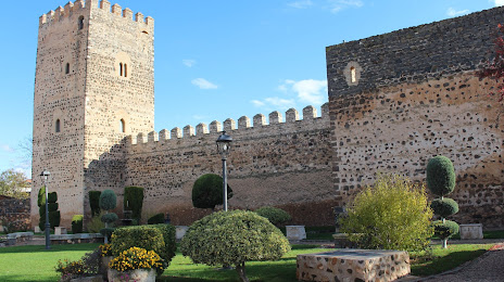
Attractions
Distance to the capital
Distance to the capital (Madrid) is about — 168 km.