Choconta — Fresno
Choconta — Marmato
Choconta — Capitanejo
Choconta — Bogota
Choconta — Marulanda
Choconta — Murillo
Choconta — San Carlos
Choconta — Ipiales
Choconta — Julio
Choconta — Soplaviento
Choconta — La Tagua
Choconta — Boyaca
Choconta — Caño Cristales
Choconta — Vichada
Choconta — Saravena
Choconta — Moñitos
Choconta — Gómez Plata
Choconta — CRUZ DEL VIZO
Choconta — Felidia
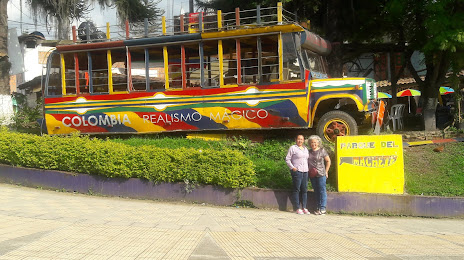
Chocontá
Sesquile
Gachancipá
Tocancipa
Sopó
Tibito
Cajica
El Canelon
Tabio
Tenjo
Stone bridge
El Rosal
Mancilla
San Francisco
San Francisco
Nocaima
Quebradanegra
Villeta
Guaduas
Honda
Mariquita
Falan
Fresno
Vereda Primavera
Padua
Mesones
Delgaditas
Letras
LA NUBIA
Villamaria
Manizales
Manizales
EL TABLAZO
La Linda
Las Pavas
Chinchina
Chinchiná
Choconta — Fresno
Choconta — Marmato
Choconta — Capitanejo
Choconta — Bogota
Choconta — Marulanda
Choconta — Murillo
Choconta — San Carlos
Choconta — Ipiales
Choconta — Julio
Choconta — Soplaviento
Choconta — La Tagua
Choconta — Boyaca
Choconta — Caño Cristales
Choconta — Vichada
Choconta — Saravena
Choconta — Moñitos
Choconta — Gómez Plata
Choconta — CRUZ DEL VIZO
Choconta — Felidia
Chocontá
Sesquile
Gachancipá
Tocancipa
Sopó
Tibito
Cajica
El Canelon
Tabio
Tenjo
Stone bridge
El Rosal
Mancilla
San Francisco
San Francisco
Nocaima
Quebradanegra
Villeta
Guaduas
Honda
Mariquita
Falan
Fresno
Vereda Primavera
Padua
Mesones
Delgaditas
Letras
LA NUBIA
Villamaria
Manizales
Manizales
EL TABLAZO
La Linda
Las Pavas
Chinchina
Chinchiná
Choconta — Santa Rosa De Cabal distance, route on the map
Distance by car
Distance between Choconta, Cundinamarca, Colombia and Santa Rosa De Cabal, Risaralda, Colombia by car is — km, or miles. To travel this distance by car, you need minute, or h.
Route on the map, driving directions
Car route Choconta — Santa Rosa De Cabal was created automatically. The road on the map is shown as a blue line. By moving the markers, you can create a new route through the points you need.
Passing cities through which the car route passes: El Sisga, Chocontá, Sesquile, Gachancipá, Tocancipa, Sopó, Tibito, Cajica, El Canelon, Tabio, Tenjo, Stone bridge, El Rosal, Mancilla, San Francisco, San Francisco, Nocaima, Quebradanegra, Villeta, Guaduas, Honda, Mariquita, Falan, Fresno, Vereda Primavera, Padua, Mesones, Delgaditas, Letras, LA NUBIA, Villamaria, Manizales, Manizales, EL TABLAZO, La Linda, Las Pavas, Chinchina, Chinchiná.
Distance by plane
If you decide to take a trip Choconta Santa Rosa De Cabal by plane, then you have to fly the distance — 216 km or 134 miles. It is marked on the map with a gray line (between two points in a straight line).
Flight time
Estimated flight time Choconta Santa Rosa De Cabal by plane at cruising speed 750 km / h will be — 17 min.
Direction of movement
Colombia, Choconta — right-hand traffic. Colombia, Santa Rosa De Cabal — right-hand traffic.
Difference in time
Choconta and Santa Rosa De Cabal are in the same time zone. Between them there is no time difference (UTC -5 America/Bogota).
Interesting Facts
Information on alternative ways to get to your destination.
The length of this distance is about 0.5% of the total length of the equator.
The percentage of the population is clearly shown in the graph:
Choconta — 7,592 (less by 50,337), Santa Rosa De Cabal — 57,929 residents.
The cost of travel
Calculate the cost of the trip yourself using the fuel consumption calculator, changing the data in the table.