Enfield — Jones County
Enfield — Tahoe Vista
Enfield — Absarokee
Enfield — Montevallo
Enfield — Mellette County
Enfield — Owenton
Enfield — Farmersville
Enfield — Louisiana
Enfield — Fennville
Enfield — Unadilla
Enfield — Independence
Enfield — Milfay
Enfield — Berclair
Enfield — Conroe
Enfield — Denning
Enfield — Hallock
Enfield — Dover
Enfield — Boon
Enfield — Mount Ulla
Hartford
Wethersfield
Newington
New Britain
Cromwell
Meriden
Wallingford
North Haven
North Haven
Hamden
New Haven
Orange
Milford
Trumbull
Bridgeport
Westport
Norwalk
New Canaan
Darien
Stamford
Greenwich
Rye Brook
Rye
New Rochelle
Pelham Manor
Mount Vernon
Bronx County
Fort Lee
Teaneck
Ridgefield Park
Palisades Park
Little Ferry
North Bergen
Secaucus
Kearny
Newark
Newark Liberty International Airport
Elizabeth
Linden
Carteret
Fords
Edison
New Brunswick
Milltown
East Brunswick
Spotswood
Jamesburg
Cranbury Township
Robbinsville
Bordentown Township
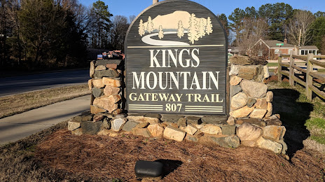
Enfield — Kings Mountain distance, route on the map
Distance by car
Distance between Enfield, Connecticut, United States and Kings Mountain, North Carolina, United States by car is — km, or miles. To travel this distance by car, you need minute, or h.
Route on the map, driving directions
Car route Enfield — Kings Mountain was created automatically. The road on the map is shown as a blue line. By moving the markers, you can create a new route through the points you need.
Passing cities through which the car route passes: Windsor Locks, Hartford, Wethersfield, Newington, New Britain, Cromwell, Meriden, Wallingford, North Haven, North Haven, Hamden, New Haven, Orange, Milford, Trumbull, Bridgeport, Westport, Norwalk, New Canaan, Darien, Stamford, Greenwich, Rye Brook, Rye, New Rochelle, Pelham Manor, Mount Vernon, Bronx County, Fort Lee, Teaneck, Ridgefield Park, Palisades Park, Little Ferry, North Bergen, Secaucus, Kearny, Newark, Newark Liberty International Airport, Elizabeth, Linden, Carteret, Fords, Edison, New Brunswick, Milltown, East Brunswick, Spotswood, Jamesburg, Cranbury Township, Robbinsville, Bordentown Township.
Distance by plane
If you decide to take a trip Enfield Kings Mountain by plane, then you have to fly the distance — 1071 km or 664 miles. It is marked on the map with a gray line (between two points in a straight line).
Flight time
Estimated flight time Enfield Kings Mountain by plane at cruising speed 750 km / h will be — 1 h. and 25 min.
Direction of movement
United States, Enfield — right-hand traffic. United States, Kings Mountain — right-hand traffic.
Difference in time
Enfield and Kings Mountain are in the same time zone. Between them there is no time difference (UTC -4 America/New_York).
Interesting Facts
Information on alternative ways to get to your destination.
The length of this distance is about 2.7% of the total length of the equator.
The cost of travel
Calculate the cost of the trip yourself using the fuel consumption calculator, changing the data in the table.