
 Ostroda
Lidzbark Warmiński
Morąg
Nidzica
Ketrzyn
Mragowo
Wlodawa
Ożarów Mazowiecki
Lubawa
Wojnicz
Szczurowa
Gąbin
Rawa Mazowiecka
Dzialdowo
Mlawa
Pultusk
Braniewo
Rawicz
Łosice
Ostroda
Lidzbark Warmiński
Morąg
Nidzica
Ketrzyn
Mragowo
Wlodawa
Ożarów Mazowiecki
Lubawa
Wojnicz
Szczurowa
Gąbin
Rawa Mazowiecka
Dzialdowo
Mlawa
Pultusk
Braniewo
Rawicz
Łosice
Zagan on the map, Poland
Where is located Zagan
Exact location — Zagan, Żagań County, Lubusz Voivodeship, Poland, marked on the map with a red marker.
Coordinates
Zagan, Poland coordinates in decimal format: latitude — 51.6178445, longitude — 15.3248325. When converted to degrees, minutes, seconds Zagan has the following coordinates: 51°37′4.24 north latitude and 15°19′29.4 east longitude.
Population
Zagan, Żagań County, Lubusz Voivodeship, Poland, according to our data the population is — 26,251 residents, which is about 0.1% of the total population of the country (Poland).
Comparison of the population on the graph:
Exact time
Time zone for this location Zagan — UTC +2 Europe/Warsaw. Exact time — monday, 5 may 2024 year, 03 h. 03 minutes.
Sunrise and sunset
Zagan, sunrise and sunset data for a date — monday 13.05.2024.
| Sunrise | Sunset | Day (duration) |
|---|---|---|
| 05:12 -2 minutes | 20:37 +2 minutes | 15 h. 24 minutes. +4 minutes |
You can control the scale of the map using the auxiliary tools to find out exactly where it is located Zagan. When you change the scale of the map, the width of the ruler also changes (in kilometers and miles).
Nearby cities
The largest cities that are located nearby:
- Zielona Gora — 37 km
- Cottbus
 (Germany) — 70 km
 - Legnica — 73 km
- Walbrzych — 114 km
- Gorzów Wielkopolski — 123 km
- Dresden (Germany) — 127 km
- Wrocław — 132 km
- Poznań — 139 km
- Berlin (Germany) — 163 km
- Berlin (Germany) — 163 km
- Potsdam (Germany) — 175 km
- Prague
 (Czech Republic) — 182 km
 - Chemnitz (Germany) — 189 km
- Kalisz — 190 km
- Leipzig (Germany) — 206 km
- Szczecin — 207 km
- Opole — 210 km
- Gera (Germany) — 240 km
- Bydgoszcz — 244 km
Distance to neighboring capitals:
- Berlin (Germany) — 165 km
- Prague (Czech Republic) — 183 km
- Vienna
 (Austria) — 387 km
 - Bratislava
 (Slovakia) — 407 km
 - Copenhagen
 (Denmark) — 486 km
 - Budapest
 (Hungary) — 531 km
 - Amsterdam
 (Netherlands) — 719 km
 - Vilnius
 (Lithuania) — 746 km
 - Bern
 (Switzerland) — 772 km
 - Rīga
 (Latvia) — 821 km
 - Belgrade
 (Serbia) — 849 km
 - Minsk
 (Belarus) — 861 km
 - Paris
 (France) — 971 km
 - Kyiv
 (Ukraine) — 1069 km
 - Helsinki
 (Finland) — 1122 km
 - Bucharest
 (Romania) — 1130 km
 - Moscow
 (Russia) — 1531 km
 - Tbilisi
 (Georgia) — 2481 km
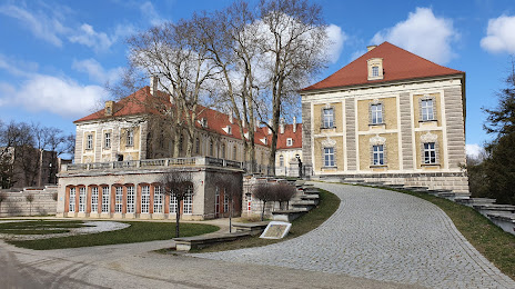
Attractions
Distance to the capital
Distance to the capital (Warsaw) is about — 396 km.