
 Jaworzno
Lipno
Karczew
Bielsk Podlaski
Siemiatycze
Mońki
Pisz
Łopiennik Górny
Pruszcz Gdański
Zambrow
Lubawa
Ożarów Mazowiecki
Wlodawa
Mragowo
Ketrzyn
Nidzica
Morąg
Lidzbark Warmiński
Ostroda
Jaworzno
Lipno
Karczew
Bielsk Podlaski
Siemiatycze
Mońki
Pisz
Łopiennik Górny
Pruszcz Gdański
Zambrow
Lubawa
Ożarów Mazowiecki
Wlodawa
Mragowo
Ketrzyn
Nidzica
Morąg
Lidzbark Warmiński
Ostroda
Zdzieszowice on the map, Poland
Where is located Zdzieszowice
Exact location — Zdzieszowice, Krapkowice County, Opole Voivodeship, Poland, marked on the map with a red marker.
Coordinates
Zdzieszowice, Poland coordinates in decimal format: latitude — 50.42422, longitude — 18.12477. When converted to degrees, minutes, seconds Zdzieszowice has the following coordinates: 50°25′27.19 north latitude and 18°7′29.17 east longitude.
Population
Zdzieszowice, Krapkowice County, Opole Voivodeship, Poland, according to our data the population is — 13,401 residents, which is about 0% of the total population of the country (Poland).
Comparison of the population on the graph:
Exact time
Time zone for this location Zdzieszowice — UTC +2 Europe/Warsaw. Exact time — thursday, 5 may 2024 year, 02 h. 18 minutes.
Sunrise and sunset
Zdzieszowice, sunrise and sunset data for a date — thursday 9.05.2024.
| Sunrise | Sunset | Day (duration) |
|---|---|---|
| 05:12 -1 minute | 20:15 +1 minute | 15 h. 6 minutes. +2 minutes |
You can control the scale of the map using the auxiliary tools to find out exactly where it is located Zdzieszowice. When you change the scale of the map, the width of the ruler also changes (in kilometers and miles).
Nearby cities
The largest cities that are located nearby:
- Opole — 31 km
- Gliwice — 41 km
- Rybnik — 46 km
- Zabrze — 48 km
- Ruda Slaska — 55 km
- Bytom — 56 km
- Chorzow — 60 km
- Katowice — 66 km
- Ostrava
 (Czech Republic) — 67 km
 - Sosnowiec — 71 km
- Dabrowa Gornicza — 76 km
- Częstochowa — 82 km
- Bielsko-Biala — 94 km
- Wrocław — 107 km
- Olomouc (Czech Republic) — 111 km
- Walbrzych — 135 km
- Kraków — 135 km
- Kalisz — 149 km
- Legnica — 162 km
Distance to neighboring capitals:
- Bratislava
 (Slovakia) — 264 km
 - Prague (Czech Republic) — 265 km
- Vienna
 (Austria) — 277 km
 - Budapest
 (Hungary) — 332 km
 - Berlin
 (Germany) — 401 km
 - Belgrade
 (Serbia) — 651 km
 - Vilnius
 (Lithuania) — 677 km
 - Copenhagen
 (Denmark) — 692 km
 - Minsk
 (Belarus) — 750 km
 - Rīga
 (Latvia) — 825 km
 - Bern
 (Switzerland) — 873 km
 - Kyiv
 (Ukraine) — 877 km
 - Bucharest
 (Romania) — 896 km
 - Amsterdam
 (Netherlands) — 942 km
 - Paris
 (France) — 1147 km
 - Helsinki
 (Finland) — 1166 km
 - Moscow
 (Russia) — 1424 km
 - Tbilisi
 (Georgia) — 2257 km
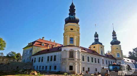
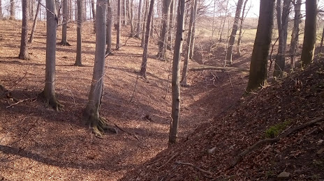
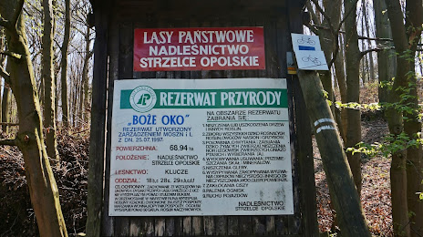
Attractions

Distance to the capital
Distance to the capital (Warsaw) is about — 284 km.