La Mata — San Antonio Del Tequendama
La Mata — Victoria
La Mata — Yotoco
La Mata — Camilo Daza International Airport
La Mata — Penthouse
La Mata — Barranca
La Mata — Pueblo Bello
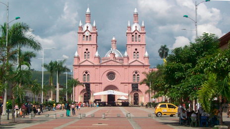
La Mata — Cali
La Mata — Puerres
La Mata — Vereda Circasia
La Mata — San Antonio del Tequendama
La Mata — Bocachica
La Mata — Arenal del Sur
La Mata — Rovira
La Mata — Medio Atrato
La Mata — El Peñón
La Mata — Papayal
La Mata — Tutazá
La Mata — Remedios
Aguachica
Icotea
San Martín
San Alberto
Chiguagua
Dagota
Yarima
Puerto Araujo-Cimitarra
Cimitarra
Puerto Serviez
Puerto Nare
Puerto Perales Nuevo
Puerto Boyacá
Puerto Triunfo
CALDAS
Puerto Salgar
La Dorada
Honda
Mariquita
Falan
Armero tragedy
Armero tragedy
Lerida
Venadillo
Alvarado
Cerco de Piedra
Chucuni
El Colegio
Ibagué
Ibague
Albania
Ibague
Cajamarca
Calarcá
Armenia
Quindio
Barcelona-Calarcá
La Tebaida
Sevilla
Corozal
Quebrada Nueva
Vallejuelo
La Paila
Uribe
Bugalagrande
Andalucía
Tulua
Narino
Riofrío
La Mata — San Antonio Del Tequendama
La Mata — Victoria
La Mata — Yotoco
La Mata — Camilo Daza International Airport
La Mata — Penthouse
La Mata — Barranca
La Mata — Pueblo Bello
La Mata — Cali
La Mata — Puerres
La Mata — Vereda Circasia
La Mata — San Antonio del Tequendama
La Mata — Bocachica
La Mata — Arenal del Sur
La Mata — Rovira
La Mata — Medio Atrato
La Mata — El Peñón
La Mata — Papayal
La Mata — Tutazá
La Mata — Remedios
Aguachica
Icotea
San Martín
San Alberto
Chiguagua
Dagota
Yarima
Puerto Araujo-Cimitarra
Cimitarra
Puerto Serviez
Puerto Nare
Puerto Perales Nuevo
Puerto Boyacá
Puerto Triunfo
CALDAS
Puerto Salgar
La Dorada
Honda
Mariquita
Falan
Armero tragedy
Armero tragedy
Lerida
Venadillo
Alvarado
Cerco de Piedra
Chucuni
El Colegio
Ibagué
Ibague
Albania
Ibague
Cajamarca
Calarcá
Armenia
Quindio
Barcelona-Calarcá
La Tebaida
Sevilla
Corozal
Quebrada Nueva
Vallejuelo
La Paila
Uribe
Bugalagrande
Andalucía
Tulua
Narino
Riofrío
La Mata — Buga distance, route on the map
Distance by car
Distance between La Mata, Cesar, Colombia and Buga, Valle del Cauca, Colombia by car is — km, or miles. To travel this distance by car, you need minute, or h.
Route on the map, driving directions
Car route La Mata — Buga was created automatically. The road on the map is shown as a blue line. By moving the markers, you can create a new route through the points you need.
Passing cities through which the car route passes: Besote, Aguachica, Icotea, San Martín, San Alberto, Chiguagua, Dagota, Yarima, Puerto Araujo-Cimitarra, Cimitarra, Puerto Serviez, Puerto Nare, Puerto Perales Nuevo, Puerto Boyacá, Puerto Triunfo, CALDAS, Puerto Salgar, La Dorada, Honda, Mariquita, Falan, Armero tragedy, Armero tragedy, Lerida, Venadillo, Alvarado, Cerco de Piedra, Chucuni, El Colegio, Ibagué, Ibague, Albania, Ibague, Cajamarca, Calarcá, Armenia, Quindio, Barcelona-Calarcá, La Tebaida, Sevilla, Corozal, Quebrada Nueva, Vallejuelo, La Paila, Uribe, Bugalagrande, Andalucía, Tulua, Narino, Riofrío.
Distance by plane
If you decide to take a trip La Mata Buga by plane, then you have to fly the distance — 601 km or 373 miles. It is marked on the map with a gray line (between two points in a straight line).
Flight time
Estimated flight time La Mata Buga by plane at cruising speed 750 km / h will be — 48 min.
Direction of movement
Colombia, La Mata — right-hand traffic. Colombia, Buga — right-hand traffic.
Difference in time
La Mata and Buga are in the same time zone. Between them there is no time difference (UTC -5 America/Bogota).
Interesting Facts
Information on alternative ways to get to your destination.
The length of this distance is about 1.5% of the total length of the equator.
The cost of travel
Calculate the cost of the trip yourself using the fuel consumption calculator, changing the data in the table.