
 Venta de Baños
Calera de León
Ferrol
Rebolledo
Coslada
Roma
Écija
Calella
Bera
Hoyos
Salt
Clariana de Cardener
La Orotava
Don Benito
Ferrero
Berge
Vega de San Mateo
Villalobos
San Andrés
Venta de Baños
Calera de León
Ferrol
Rebolledo
Coslada
Roma
Écija
Calella
Bera
Hoyos
Salt
Clariana de Cardener
La Orotava
Don Benito
Ferrero
Berge
Vega de San Mateo
Villalobos
San Andrés
Villena on the map, Spain
Where is located Villena
Exact location — Villena, Alicante, Comunidad Valenciana, Spain, marked on the map with a red marker.
Coordinates
Villena, Spain coordinates in decimal format: latitude — 38.6318196, longitude — -0.8612206. When converted to degrees, minutes, seconds Villena has the following coordinates: 38°37′54.55 north latitude and -0°51′40.39 east longitude.
Population
Villena, Alicante, Comunidad Valenciana, Spain, according to our data the population is — 38,150 residents, which is about 0.1% of the total population of the country (Spain).
Comparison of the population on the graph:
Exact time
Time zone for this location Villena — UTC +2 Europe/Madrid. Exact time — friday, 5 may 2024 year, 20 h. 03 minutes.
Sunrise and sunset
Villena, sunrise and sunset data for a date — friday 10.05.2024.
| Sunrise | Sunset | Day (duration) |
|---|---|---|
| 06:58 -1 minute | 21:00 +1 minute | 14 h. 0 minutes. +2 minutes |
You can control the scale of the map using the auxiliary tools to find out exactly where it is located Villena. When you change the scale of the map, the width of the ruler also changes (in kilometers and miles).
Nearby cities
The largest cities that are located nearby:
- Murcia — 75 km
- Albacete — 95 km
- Valencia — 101 km
- Cartagena — 112 km
- Almería — 244 km
- Jaén — 272 km
- Granada — 290 km
- Alcala de Henares — 293 km
- Torrejón de Ardoz — 298 km
- Getafe — 305 km
- Fuenlabrada — 309 km
- Leganés — 309 km
- Alcorcón — 314 km
- Alcobendas — 314 km
- Móstoles — 315 km
- Palma — 317 km
- Oran
 (Algeria) — 325 km
 - Tarragona — 326 km
- Zaragoza — 334 km
Distance to neighboring capitals:
- Andorra la Vella
 (Andorra) — 476 km
 - Lisbon
 (Portugal) — 719 km
 - Rabat
 (Morocco) — 746 km
 - Paris
 (France) — 1166 km
 - Paris (France) — 1166 km
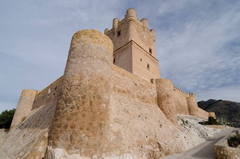
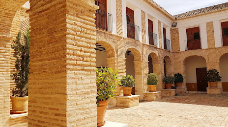
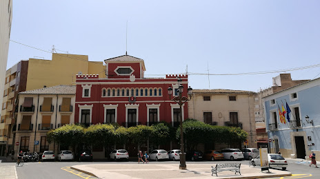
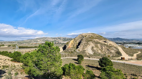
Attractions


Distance to the capital
Distance to the capital (Madrid) is about — 314 km.