
 Santa Cristina d'Aro
La Cañada de Verich
Vilagarcía de Arousa
Piera
Sant Joan de Moró
A Pobra de Trives
Foz
Calasparra
Camprovín
Jafre
El Arenal
Mocejón
Las Quintanillas
Torroella de Montgrí
Benicàssim
Madremanya
Tricio
La Vall d'Uixó
Son Servera
Santa Cristina d'Aro
La Cañada de Verich
Vilagarcía de Arousa
Piera
Sant Joan de Moró
A Pobra de Trives
Foz
Calasparra
Camprovín
Jafre
El Arenal
Mocejón
Las Quintanillas
Torroella de Montgrí
Benicàssim
Madremanya
Tricio
La Vall d'Uixó
Son Servera
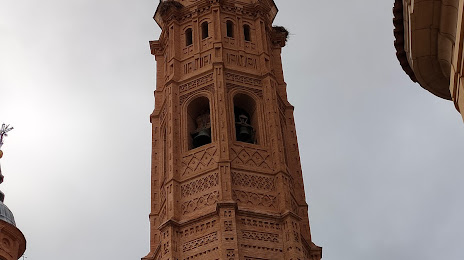
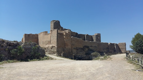
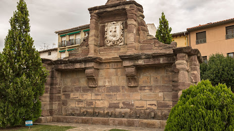
Calatayud on the map, Spain
Where is located Calatayud
Exact location — Calatayud, Zaragoza, Aragón, Spain, marked on the map with a red marker.
Coordinates
Calatayud, Spain coordinates in decimal format: latitude — 41.3531678, longitude — -1.6468455. When converted to degrees, minutes, seconds Calatayud has the following coordinates: 41°21′11.4 north latitude and -1°38′48.64 east longitude.
Population
Calatayud, Zaragoza, Aragón, Spain, according to our data the population is — 18,623 residents, which is about 0% of the total population of the country (Spain).
Comparison of the population on the graph:
Exact time
Time zone for this location Calatayud — UTC +2 Europe/Madrid. Exact time — thursday, 5 may 2024 year, 02 h. 41 minute.
Sunrise and sunset
Calatayud, sunrise and sunset data for a date — thursday 2.05.2024.
| Sunrise | Sunset | Day (duration) |
|---|---|---|
| 07:05 -1 minute | 21:01 +1 minute | 13 h. 54 minutes. +2 minutes |
You can control the scale of the map using the auxiliary tools to find out exactly where it is located Calatayud. When you change the scale of the map, the width of the ruler also changes (in kilometers and miles).
Nearby cities
The largest cities that are located nearby:
- Zaragoza — 71 km
- Logroño — 139 km
- Pamplona — 161 km
- Alcala de Henares — 174 km
- Torrejón de Ardoz — 183 km
- Vitoria-Gasteiz — 186 km
- Lleida — 190 km
- Alcobendas — 190 km
- Burgos — 200 km
- Getafe — 210 km
- Leganés — 211 km
- Alcorcón — 215 km
- Fuenlabrada — 217 km
- San Sebastián — 219 km
- Móstoles — 219 km
- Valencia — 235 km
- Bilbao — 235 km
- Tarragona — 242 km
- Valladolid — 256 km
Distance to neighboring capitals:
- Andorra la Vella
 (Andorra) — 292 km
 - Lisbon
 (Portugal) — 702 km
 - Paris
 (France) — 891 km
 - Paris (France) — 891 km
- Rabat
 (Morocco) — 940 km
Attractions


Distance to the capital
Distance to the capital (Madrid) is about — 202 km.