
 Albesa
Llanes
Cartes
Garcia
Martínez
Palacios del Sil
Lucainena de las Torres
Leganés
Mollet del Vallès
Albacete
Guadalajara
Isla Mayor
Tajonar
Linares
Palafrugell
Palamós
Algemesí
Lorca
Al-Andalus
Albesa
Llanes
Cartes
Garcia
Martínez
Palacios del Sil
Lucainena de las Torres
Leganés
Mollet del Vallès
Albacete
Guadalajara
Isla Mayor
Tajonar
Linares
Palafrugell
Palamós
Algemesí
Lorca
Al-Andalus
Utrera on the map, Spain
Where is located Utrera
Exact location — Utrera, Sevilla, Andalucía, Spain, marked on the map with a red marker.
Coordinates
Utrera, Spain coordinates in decimal format: latitude — 37.1848134, longitude — -5.7795147. When converted to degrees, minutes, seconds Utrera has the following coordinates: 37°11′5.33 north latitude and -5°46′46.25 east longitude.
Population
Utrera, Sevilla, Andalucía, Spain, according to our data the population is — 46,361 residents, which is about 0.1% of the total population of the country (Spain).
Comparison of the population on the graph:
Exact time
Time zone for this location Utrera — UTC +2 Europe/Madrid. Exact time — sunday, 4 april 2024 year, 11 h. 18 minutes.
Sunrise and sunset
Utrera, sunrise and sunset data for a date — sunday 28.04.2024.
| Sunrise | Sunset | Day (duration) |
|---|---|---|
| 07:34 -1 minute | 21:06 +1 minute | 13 h. 30 minutes. +2 minutes |
You can control the scale of the map using the auxiliary tools to find out exactly where it is located Utrera. When you change the scale of the map, the width of the ruler also changes (in kilometers and miles).
Nearby cities
The largest cities that are located nearby:
- Dos Hermanas — 17 km
- Jerez — 63 km
- Cádiz — 86 km
- Huelva — 103 km
- Marbella — 109 km
- Córdoba — 117 km
- Algeciras — 119 km
- Málaga — 128 km
- Tangier
 (Morocco) — 158 km
 - Tetouan (Morocco) — 183 km
- Jaén — 186 km
- Granada — 192 km
- Badajoz — 214 km
- Almería — 296 km
- Taounate (Morocco) — 311 km
- Kenitra (Morocco) — 333 km
- Lisbon
 (Portugal) — 336 km
 - Nador (Morocco) — 341 km
- Amadora (Portugal) — 344 km
Distance to neighboring capitals:
- Lisbon (Portugal) — 341 km
- Rabat (Morocco) — 370 km
- Andorra la Vella
 (Andorra) — 859 km
 - Paris
 (France) — 1455 km
 - Paris (France) — 1455 km
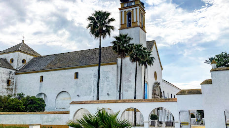
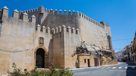
Attractions


Distance to the capital
Distance to the capital (Madrid) is about — 402 km.