
 Melilla
Ceuta
San Vicente
Roquetas de Mar
Utrera
Bustillo del Páramo
Nueva
Jaén
Cuevas del Almanzora
Huelva
Badajoz
Padilla de Abajo
Andoain
Anaya de Alba
Segovia
Sarria
Plan
Gijón
Carballo
Melilla
Ceuta
San Vicente
Roquetas de Mar
Utrera
Bustillo del Páramo
Nueva
Jaén
Cuevas del Almanzora
Huelva
Badajoz
Padilla de Abajo
Andoain
Anaya de Alba
Segovia
Sarria
Plan
Gijón
Carballo
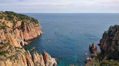
Palafrugell on the map, Spain
Where is located Palafrugell
Exact location — Palafrugell, Girona, Catalunya, Spain, marked on the map with a red marker.
Coordinates
Palafrugell, Spain coordinates in decimal format: latitude — 41.9179112, longitude — 3.1629611. When converted to degrees, minutes, seconds Palafrugell has the following coordinates: 41°55′4.48 north latitude and 3°9′46.66 east longitude.
Population
Palafrugell, Girona, Catalunya, Spain, according to our data the population is — 20,830 residents, which is about 0% of the total population of the country (Spain).
Comparison of the population on the graph:
Exact time
Time zone for this location Palafrugell — UTC +2 Europe/Madrid. Exact time — thursday, 5 may 2024 year, 09 h. 18 minutes.
Sunrise and sunset
Palafrugell, sunrise and sunset data for a date — thursday 9.05.2024.
| Sunrise | Sunset | Day (duration) |
|---|---|---|
| 06:36 -1 minute | 20:51 +1 minute | 14 h. 18 minutes. +2 minutes |
You can control the scale of the map using the auxiliary tools to find out exactly where it is located Palafrugell. When you change the scale of the map, the width of the ruler also changes (in kilometers and miles).
Nearby cities
The largest cities that are located nearby:
- Mataró — 73 km
- Perpignan
 (France) — 88 km
 - Badalona — 92 km
- Santa Coloma de Gramenet — 95 km
- Sabadell — 96 km
- Terrassa — 103 km
- L'Hospitalet de Llobregat — 106 km
- Tarragona — 183 km
- Montpellier (France) — 196 km
- Lleida — 213 km
- Toulouse (France) — 232 km
- Nimes (France) — 233 km
- Marseille (France) — 234 km
- Aix-en-Provence (France) — 256 km
- Toulon (France) — 260 km
- Palma — 263 km
- Zaragoza — 336 km
- Nice (France) — 383 km
- Saint-Étienne (France) — 401 km
Distance to neighboring capitals:
- Andorra la Vella
 (Andorra) — 150 km
 - Paris (France) — 774 km
- Paris (France) — 774 km
- Lisbon
 (Portugal) — 1101 km
 - Rabat
 (Morocco) — 1244 km
Attractions


Distance to the capital
Distance to the capital (Madrid) is about — 599 km.