Visalia — Moundsville
Visalia — Fillmore
Visalia — Mechanicsburg
Visalia — Ellery
Visalia — Patterson
Visalia — Clarinda
Visalia — Yorkshire
Visalia — South Byron
Visalia — Bombay Beach
Visalia — Beckwourth
Visalia — Carmel-by-the-Sea
Visalia — Omaha
Visalia — Louann
Visalia — Richmond
Visalia — Neodesha
Visalia — Cresco
Visalia — Whittemore
Visalia — Battletown
Visalia — Wattsville
Goshen
Traver
Kingsburg
Malaga
Fresno
Raco
Madera
Chowchilla
Merced
Atwater
Cressey
Ballico
Turlock
Keyes
Ceres
Modesto
Modesto
Ripon
Manteca
Stockton Metropolitan Airport
Stockton
Lodi
Galt
Elk Grove
Elk Grove
Laguna
Sacramento
West Sacramento
Woodland
Yolo County
Zamora
Dunnigan
Arbuckle
Genevra
Williams
Willows
Orland
Tehama
Red Bluff
Redding
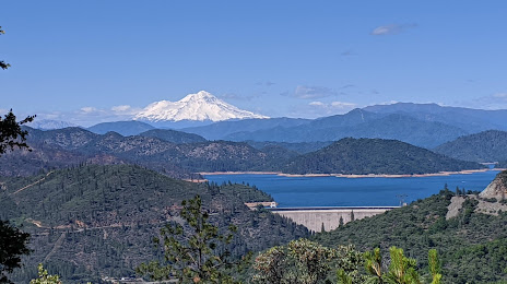
Visalia — Shasta Lake distance, route on the map
Distance by car
Distance between Visalia, California, United States and Shasta Lake, California, United States by car is — km, or miles. To travel this distance by car, you need minute, or h.
Route on the map, driving directions
Car route Visalia — Shasta Lake was created automatically. The road on the map is shown as a blue line. By moving the markers, you can create a new route through the points you need.
Passing cities through which the car route passes: Midvalley, Goshen, Traver, Kingsburg, Malaga, Fresno, Raco, Madera, Chowchilla, Merced, Atwater, Cressey, Ballico, Turlock, Keyes, Ceres, Modesto, Modesto, Ripon, Manteca, Stockton Metropolitan Airport, Stockton, Lodi, Galt, Elk Grove, Elk Grove, Laguna, Sacramento, West Sacramento, Woodland, Yolo County, Zamora, Dunnigan, Arbuckle, Genevra, Williams, Willows, Orland, Tehama, Red Bluff, Redding.
Distance by plane
If you decide to take a trip Visalia Shasta Lake by plane, then you have to fly the distance — 553 km or 343 miles. It is marked on the map with a gray line (between two points in a straight line).
Flight time
Estimated flight time Visalia Shasta Lake by plane at cruising speed 750 km / h will be — 44 min.
Direction of movement
United States, Visalia — right-hand traffic. United States, Shasta Lake — right-hand traffic.
Difference in time
Visalia and Shasta Lake are in the same time zone. Between them there is no time difference (UTC -7 America/Los_Angeles).
Interesting Facts
Information on alternative ways to get to your destination.
The length of this distance is about 1.4% of the total length of the equator.
The percentage of the population is clearly shown in the graph:
Visalia — 107,431, Shasta Lake — 10,611 residents (less by 96,820).
The cost of travel
Calculate the cost of the trip yourself using the fuel consumption calculator, changing the data in the table.
Calculate the cost of other distances from the starting point — Visalia.