
 Lidzbark Warmiński
Morąg
Nidzica
Ketrzyn
Mragowo
Wlodawa
Ożarów Mazowiecki
Lubawa
Zambrow
Ciężkowice
Wojnicz
Szczurowa
Gąbin
Rawa Mazowiecka
Dzialdowo
Mlawa
Pultusk
Braniewo
Rawicz
Lidzbark Warmiński
Morąg
Nidzica
Ketrzyn
Mragowo
Wlodawa
Ożarów Mazowiecki
Lubawa
Zambrow
Ciężkowice
Wojnicz
Szczurowa
Gąbin
Rawa Mazowiecka
Dzialdowo
Mlawa
Pultusk
Braniewo
Rawicz
Zgorzelec on the map, Poland
Where is located Zgorzelec
Exact location — Zgorzelec, Zgorzelec County, Lower Silesian Voivodeship, Poland, marked on the map with a red marker.
Coordinates
Zgorzelec, Poland coordinates in decimal format: latitude — 51.1496361, longitude — 15.0065645. When converted to degrees, minutes, seconds Zgorzelec has the following coordinates: 51°8′58.69 north latitude and 15°0′23.63 east longitude.
Population
Zgorzelec, Zgorzelec County, Lower Silesian Voivodeship, Poland, according to our data the population is — 33,247 residents, which is about 0.1% of the total population of the country (Poland).
Comparison of the population on the graph:
Exact time
Time zone for this location Zgorzelec — UTC +2 Europe/Berlin. Exact time — thursday, 5 may 2024 year, 03 h. 57 minutes.
Sunrise and sunset
Zgorzelec, sunrise and sunset data for a date — thursday 9.05.2024.
| Sunrise | Sunset | Day (duration) |
|---|---|---|
| 05:21 -2 minutes | 20:30 +1 minute | 15 h. 12 minutes. +3 minutes |
You can control the scale of the map using the auxiliary tools to find out exactly where it is located Zgorzelec. When you change the scale of the map, the width of the ruler also changes (in kilometers and miles).
Nearby cities
The largest cities that are located nearby:
- Legnica — 80 km
- Cottbus
 (Germany) — 81 km
 - Dresden (Germany) — 89 km
- Zielona Gora — 93 km
- Walbrzych — 98 km
- Prague
 (Czech Republic) — 125 km
 - Wrocław — 141 km
- Chemnitz (Germany) — 150 km
- Gorzów Wielkopolski — 176 km
- Leipzig (Germany) — 183 km
- Berlin (Germany) — 185 km
- Berlin (Germany) — 186 km
- Potsdam (Germany) — 190 km
- Poznań — 190 km
- Pilsen (Czech Republic) — 195 km
- Gera (Germany) — 206 km
- Opole — 211 km
- Kalisz — 221 km
- Olomouc (Czech Republic) — 236 km
Distance to neighboring capitals:
- Prague (Czech Republic) — 126 km
- Berlin (Germany) — 188 km
- Vienna
 (Austria) — 342 km
 - Bratislava
 (Slovakia) — 367 km
 - Budapest
 (Hungary) — 500 km
 - Copenhagen
 (Denmark) — 529 km
 - Amsterdam
 (Netherlands) — 709 km
 - Bern
 (Switzerland) — 722 km
 - Vilnius
 (Lithuania) — 792 km
 - Belgrade
 (Serbia) — 815 km
 - Rīga
 (Latvia) — 876 km
 - Minsk
 (Belarus) — 902 km
 - Paris
 (France) — 939 km
 - Kyiv
 (Ukraine) — 1092 km
 - Bucharest
 (Romania) — 1114 km
 - Helsinki
 (Finland) — 1179 km
 - Moscow
 (Russia) — 1574 km
 - Tbilisi
 (Georgia) — 2490 km
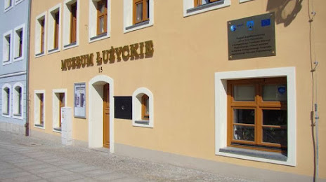
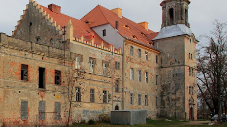
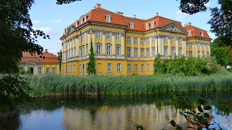
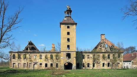
Attractions


Distance to the capital
Distance to the capital (Warsaw) is about — 431 km.