San Jose — Wofford Heights
San Jose — Lakeville
San Jose — Tioga
San Jose — Fond du Lac
San Jose — Scottsdale
San Jose — Davenport
San Jose — Dallas County
San Jose — Boston Logan International Airport
San Jose — Rockingham County
San Jose — Lytle
San Jose — Burkittsville
San Jose — Rome
San Jose — Estacada
San Jose — Pennellville
San Jose — Belton
San Jose — Hyner
San Jose — Karnes City
San Jose — Abilene
San Jose — Bigler
Milpitas
Fremont
Sunol
Pleasanton
Dublin
San Ramon
Danville
Alamo
Walnut Creek
Pleasant Hill
Pacheco
Martinez
Benicia
Suval
Fairfield
Vacaville
Winters
Madison
Zamora
Dunnigan
Arbuckle
Genevra
Williams
Willows
Orland
Tehama
Red Bluff
Redding
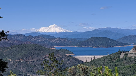
San Jose — Shasta Lake distance, route on the map
Distance by car
Distance between San Jose, California, United States and Shasta Lake, California, United States by car is — km, or miles. To travel this distance by car, you need minute, or h.
Route on the map, driving directions
Car route San Jose — Shasta Lake was created automatically. The road on the map is shown as a blue line. By moving the markers, you can create a new route through the points you need.
Passing cities through which the car route passes: Alum Rock, Milpitas, Fremont, Sunol, Pleasanton, Dublin, San Ramon, Danville, Alamo, Walnut Creek, Pleasant Hill, Pacheco, Martinez, Benicia, Suval, Fairfield, Vacaville, Winters, Madison, Zamora, Dunnigan, Arbuckle, Genevra, Williams, Willows, Orland, Tehama, Red Bluff, Redding.
Distance by plane
If you decide to take a trip San Jose Shasta Lake by plane, then you have to fly the distance — 374 km or 232 miles. It is marked on the map with a gray line (between two points in a straight line).
Flight time
Estimated flight time San Jose Shasta Lake by plane at cruising speed 750 km / h will be — 29 min.
Direction of movement
United States, San Jose — right-hand traffic. United States, Shasta Lake — right-hand traffic.
Difference in time
San Jose and Shasta Lake are in the same time zone. Between them there is no time difference (UTC -7 America/Los_Angeles).
Interesting Facts
Information on alternative ways to get to your destination.
The length of this distance is about 0.9% of the total length of the equator.
The percentage of the population is clearly shown in the graph:
San Jose — 897,460, Shasta Lake — 10,611 residents (less by 886,849).
The cost of travel
Calculate the cost of the trip yourself using the fuel consumption calculator, changing the data in the table.
Calculate the cost of other distances from the starting point — San Jose.