Catalina — Newfane
Catalina — Leander
Catalina — Mount Jewett
Catalina — Bellbrook
Catalina — Aniak
Catalina — Bridgeton
Catalina — Broken Arrow
Catalina — Crescent City
Catalina — Milo
Catalina — Sheridan Airport
Catalina — Moorpark
Catalina — Bryce Canyon
Catalina — Lynnwood
Catalina — Florida City
Catalina — Mannsville
Catalina — Phoenix
Catalina — Lyles
Catalina — Georgetown
Catalina — Madison County
Picacho
Eloy
Arizona City
Casa Grande
Sacaton
Casa Blanca
Tempe
Phoenix Sky Harbor International Airport
Phoenix
Phoenix
Tolleson
Avondale
Goodyear
Buckeye
Quartzsite
Ehrenberg
Blythe
Cactus City
Thermal
Indio
Indian Wells
Thousand Palms
Palm Springs
North Palm Springs
Cabazon
Banning
Cherry Valley
Calimesa
Redlands
Loma Linda
Colton
Rialto
Fontana
Ontario
LA/Ontario International Airport
Ontario
Upland
Upland
Claremont
Pomona
Diamond Bar
San Dimas
Covina
West Covina
Baldwin Park
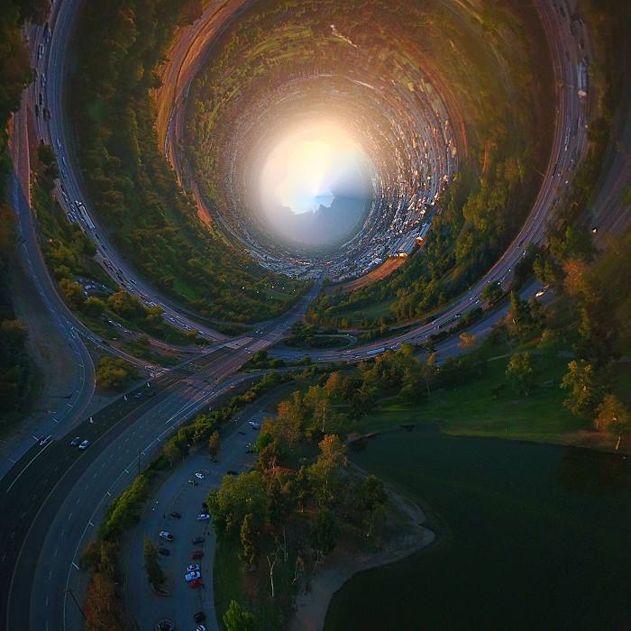
Catalina — El Monte distance, route on the map
Distance by car
Distance between Catalina, Arizona, United States and El Monte, California, United States by car is — km, or miles. To travel this distance by car, you need minute, or h.
Route on the map, driving directions
Car route Catalina — El Monte was created automatically. The road on the map is shown as a blue line. By moving the markers, you can create a new route through the points you need.
Passing cities through which the car route passes: Marana, Picacho, Eloy, Arizona City, Casa Grande, Sacaton, Casa Blanca, Tempe, Phoenix Sky Harbor International Airport, Phoenix, Phoenix, Tolleson, Avondale, Goodyear, Buckeye, Quartzsite, Ehrenberg, Blythe, Cactus City, Thermal, Indio, Indian Wells, Thousand Palms, Palm Springs, North Palm Springs, Cabazon, Banning, Cherry Valley, Calimesa, Redlands, Loma Linda, Colton, Rialto, Fontana, Ontario, LA/Ontario International Airport, Ontario, Upland, Upland, Claremont, Pomona, Diamond Bar, San Dimas, Covina, West Covina, Baldwin Park.
Distance by plane
If you decide to take a trip Catalina El Monte by plane, then you have to fly the distance — 683 km or 423 miles. It is marked on the map with a gray line (between two points in a straight line).
Flight time
Estimated flight time Catalina El Monte by plane at cruising speed 750 km / h will be — 54 min.
Direction of movement
United States, Catalina — right-hand traffic. United States, El Monte — right-hand traffic.
Difference in time
Catalina and El Monte are in the same time zone. Between them there is no time difference (UTC -7 America/Phoenix).
Interesting Facts
Information on alternative ways to get to your destination.
The length of this distance is about 1.7% of the total length of the equator.
The percentage of the population is clearly shown in the graph:
Catalina — 7,569 (less by 117,803), El Monte — 125,372 residents.
The cost of travel
Calculate the cost of the trip yourself using the fuel consumption calculator, changing the data in the table.